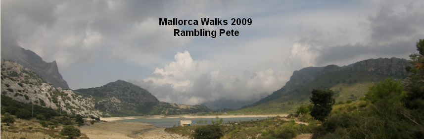
28th September 2009
Map: Mallorca Tramuntana Central 1:25000
Weather: Typical Manchester Weather
From Valldemossa along the valley of Es Cairats up to the Font des Polls. Turn right up the Serra des Cairats up to Es Teix. Walk down to the Archdukes path and around to Talaia Vella, and then drop down back to Valldemossa: 12.6 miles by Satmap Active 10 gps in 6 1/4 hrs
I was looking at the map of this walk upside down, and originally I had planned to walk out to Sa Galera across a stony plateau called Es Boixos. When I was reading it, it looked like Es Bollox so I didn’t bother going out to Sa Galera – the weather was rubbish anyway. When I woke this morning it looked ok outside so I took my chance and drove down to the start at Valldemossa. But when I got there I could see the low clouds around the higher peaks, but I thought I would carry on anyway – it was just like being in Manchester, but sunnier and quieter. I parked by the local football stadium – a good landmark and adjacent to the finishing point as well, with free parking.

On the outskirts of Valldemossa – up to the left

Looking back to Valldemossa

A gentle ascent into the rain
There were a few black vultures circling high above, so high that I thought that they were crows, but they were the real thing – big birds they are. Lots of the paths around here were built by the Archduke Lluis Salvadore back in the 1800’s, and he was quite a conservationist apparently. He certainly made the walking easy across difficult terrain – what a gent. Once I was kitted out I set the Satmap going and picked up plenty of satellites, checked my position on the map and started the long uphill section along Es Cairats, that’s Spanish for Jasper Carrot Way. The ascent was gentle for quite a way along a farm track that runs all the way up to the refuge where I turned off. I could see my fate early on as the rain clouds were clinging to the head of the valley, and coming from sunny Manchester I know what a rain cloud looks like – just like a walk in the Lake District except warmer.

A deep snow hole

Valldemossa far below, from the junction of Serra des Cairats

Looking down to the valley from the Serra des Cairats
I was aware of my misadventure on La Maroma (Andalucia) the previous year, so I made sure my compass and a GOOD map were handy. I had read through the Cicerone guide that Muz had kindly sent to me, so I had a reasonable idea of what was coming. I also figured fairly early on that I would have to bin the idea of the walk across to Sa Gomera – but I wouldn’t have seen anything, and it would have been all compass work, and not worth 3hrs in more cloud. So I changed the route slightly to include Talaia Vella, and what a delight it was – every cloud has a silver lining etc – it’s true, but only if you’re hill walking. It was very quiet down in the valley and I didn’t meet anyone except some goats with some superb curly horns. Unfortunately for the camera they were quite fleet of foot and scarpered as soon as they heard me coming along.

A threshing floor

Windy and wet ahead

On my way up to the summit of Es Teix
In the lower valley the cultivated terraces gave way to some wooded areas that have taken over the old terraces. Holm Oaks dominated the higher slopes, and I saw my first snow hole – deeply impressive, but built too low on the slope to preserve the winter snow apparently. There were also plenty of threshing floors\drying floors – usually close to the snow holes. These were layered rounds of ground that were mostly covered with moss – lovely and flat. There must have been a good deal of cultivation up these higher slopes back in the 18th century, but not much going on up here nowadays – too labour intensive I suppose. The track steepened as it went higher up towards the spring called Font des Polls, and I rested my sweaty torso here and had a good gulp of juice and a snack before carrying on.

The summit trig

I couldn’t see much around me

Eventually I met up with some recognisable paths
I left the good track here to follow an old mule track called the Serra des Cairats that eventually leads up to the Puig Es Teix. I checked the map and noted that this was a one way trip to the top, with a dead end branch at the end of the mule route – so I remembered to take a significant left turn when it came along. The path rose steeply up the valley side in a series of zigzags, with partial views down to the valley floor below. At this point it started to drop big watery blobs on my sparse tonsure, so it was on with the full waterproofs, and despite the sweaty climb, it kept out the wind and the rain – and boy did it rain. It was head down for a little while to avoid the worst and I reached the left turn and took it, even though the route was tempting me onwards to the dead end. I plodded steadily upwards sighting and following the stone cairns across the bare limestone pavement.

No signs coming from the other way though

A locked gate!

This cairn marks the junction of the Archdukes path

The Archdukes path ahead
Eventually I came up above the treeline and it lashed it down – I don’t think I have been out in rain like it for a long, long time. But in my head I knew that once I’d been up to the top in the mist, it would be back down below the cloud base soon enough. I knew which way the trig point was and took a bearing for it as I didn’t want to stray too far down the lee slope, I stayed up close to the escarpment edge that would lead me up to Es Teix. I couldn’t see very far and spent quite a bit of time walking sideways and admiring the plant life at my feet. It was good to see the flowering autumn crocus – Colchicums, and the usual herb garden shrubs of Rosemary and Thyme, and carefully avoided the nasty spiky mounds. The last bit to the summit was a fairly well trodden path, and I knew I was there because I bumped into the trig point. No great cairn up here, just a length of round steel pipe and a small plaque. I didn’t hang around as it was fairly inhospitable weather, but at least I have an excuse to return now.

It winds its way to higher ground


The cobble edged path in good condition

Looking back over the higher ground
I checked the map again and took a bearing to lead me down off the summit NNW. I soon found the trace of a path down a steep slope, but kept checking my direction – I’m a bit paranoid now! But it was well used and wound down to lower ground. I soon came down through the mist and spotted an estate track and a footpath beyond, both leading off in a westerly direction. It was nice to see a little ahead of me and the rain eased off as I came to the edge of the private estate. Here was a bizarre sight as there was a big stile up and over the well made wall, with a padlocked gate at the top. It didn’t make a blind bit of difference as you can just step on the wall easily enough and down the other side. From this point onwards it was still misty with showers, but got dryer and clearer the further west I walked. From the stile there was a rocky path down to meet up with the Archdukes path, with a small scrambly bit but no difficulty.

Easy walking along the tops

The path runs along the top edge of the escarpment

Looking down on the Archdukes old place

A horse trough?
Once down at the col a large pile of stones marks the junction with the path that comes up from Es Cairats past the refugi, and joins up to the Archdukes path. Here it was an unmistakeable made path, lined by limestone kerbs with crushed stone in between. It must have been like walking in the park in its heyday – a fine achievement by a forward thinking Gent of the 19th Century. The route took me to the right of the cairn and it was easy to stride out along the path, although it was still a little damp. The path is clear and gently climbs and descends, and I suppose the views from here must be magnificent on a clear crisp day. There is a viewpoint at one stage that looks down onto Deia below and I could pick out the villa we were staying in. Unfortunately Port Soller further up the coast was obscured by low cloud scudding across, but I kept getting glimpses, almost seeing the highest peak on the island at one point. There was a gentle ascent up the slopes to Puig Gross and the path tries to stick as near to the edge as it can, it certainly passes over some rocky patches, and must have taken a good deal of labour to build this, although most of the material would have come from the surrounding sandy slopes. After dropping down on a winding path to the next col at the Pla des Aritges – plain of the spikey things, there is another pile of stones marking a route down to the left that would lead you back to Valldemossa.

The path covers some rough ground easily

But don’t stand to close to the edge

Looking back along the escarpment

Port Soller in the distance
But my route was straight on the delightful Archdukes path, to Es Caragoli – the third 3000ft plus peak today ( Es Teix – 3557ft, Puig Gros – 3077ft), where there is a small plaque dedicated to the Archduke – maybe they should call all the peaks in Mallorca over 3000ft Archdukes, like Munros? Beyond Es Caragoli the path sticks very close to the edge and there are some fantastic views and vertiginous drops in places, and fittingly the weather continued to brighten. The Archdukes former estate and house of Son Marroig came into view far below, with the distinctive spur of land behind – a headland with a hole in it. I continued along the edge of the limestone scarp, ignoring any turn offs to the left that would have taken me back down to Valldemossa. There is an interesting depression in one of the rocks next to the path, being a symmetrical round depression at about the right height to be used as a drinking bowl for any passing horse or mule. I had a close look at this and I’m sure it is the hand of Manuel labour, as none of the other rocks I passed today had anything remotely similar.

The hermitage

Lovely windows

The view back to the escarpment

Deia far below
At the end of the escarpment the path turns down the lee slope and zigzags down to the Coll de Son Gallard, passing a small hermitage set into and below some rocks. The hermitage has signs requesting silence, and very peaceful it is here. It reminded me of the Monty Python sketch about the hermit having not spoken for years – I wondered how many tourists came knocking at the little door. It had a couple of plywood windows and some plastic sheeting for a roof, but it must be perishing cold in the winter months, although there is plenty of firewood lying around. So I trod softly and left by the way I had arrived, and soon got down to a crossroad of paths at the col.

The view from the Archdukes folly on

Through the square window

Looking inland

The trig point on Taleia Vella
Here I could have turned left to drop down the GR221 to Valldemossa or right to Deia – maybe next time. My route was straight up the hillside up towards the Archdukes summer house folly type building. There was an awful smell of goats’ doings low down on the slopes but thankfully that was soon behind, and the views behind me opened up to the escarpment I’d walked earlier. Up at the small building it was time for some more refreshments and to take in the vista. They must have had some good times up here, as the views are spectacular. I nearly had great views but the cloud was still spilling over Es Boixos the bollox. After a mooch around the remains it was a short walk through old olive trees to the trig point – a proper one this time, before turning downhill to wind my way back towards Valldemossa.

Looking back to the folly from the trig point

The view down to the South West

Valldemossa is just around the corner

The path crosses much limestone pavement
There were more snow holes, threshing floors, limestone pavement and goats trying to climb trees to get at the leaves. I’d noticed an interesting plant today, with fat waxy leaves, and a purple bract and stem of a flower – not the most attractive, but different for sure. It was downhill all the way now, with the path zigzagging down the hill gracefully – but it was quite full of rubble in places and hard on the feet. At the Mirador de Can Costa I stopped to take in the surrounding countryside with far views down the coast to the south west – made me think of all the people frying on the beach who never see such beauty – all the more for me though. Eventually the path met up with the GR221 leading back down to Valldemossa. It worked its way through a dreary patch of charcoal burner’s woods, with plenty of coppiced trees abounding and some large square piles of stones – don’t know what these were used for.

The stony path down to Valldemossa

Water flows down off the mountains through old pipework - sometimes
Then it was on to more downhill, steeply in places but easy going and eventually a glimpse of the Astroturf pitch in Valldemossa, so I knew I wasn’t far away. I came out onto a road next to a fence with a small sign pointing the way to Es Teix and wandered through the streets to the car. It was a great walk, very satisfying with something for all, but my shins weren’t half sore from last week’s walk in Glencoe – it’s worth the pain though. All that was needed know was the short drive back to Deia for a nice cooling San Miguel – not a bad day out after all.

No comments:
Post a Comment