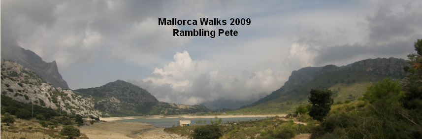
1st October 2009
Map: Mallorca Tramuntana Central 1:25000
Weather: Sunshine with some cloudy patches
A round from Cuber reservoir up to Sa Rateta, along the ridge to na Franquesa and Puig de l’Ofre. Drop down to the GR221 and return to the start: 8 miles by Satmap gps in 5 hrs, with plenty of stops.
Big black clouds swathed the hills behind Deia, which was disappointing as I was going to be up at the same height a little further inland. I expected the worse when I drove over to Soller and saw the backdrop of swirling clouds over the higher peaks, with the valley covered in a veil of smoke from 2 fires in the town. Leaving Soller on the road to Cuber is a slow grind uphill most of the way, which meant the walk starting at a height of 2600ft, so the car does most of the work thankfully.

Early morning smog over Soller – weather a bit gloomy!

But by the time I got to Cuber, I could see Puig Major

However my walk was looking a bit misty

Below the dam
The highest peak today was sa Rateta at 3650ft, and it was still a good work out in getting up there. This was essentially a ridge walk with a return to the valley back to the start – nice and simple and hard to go wrong you would assume. I parked the car by the entrance to the reservoir and there were already a good few people out and about, some picking mushrooms and plenty of others bird watching. This is a good spot for seeing the Black Vultures flying overhead, and the guide book says it’s also good for spotting Ospreys. But with so many people around I doubted it, and it’s probably only a certain time of year that they can be seen. The highest peak in Mallorca was bearing its head occasionally, and it wears a great big golf ball – an army radar station apparently – Puig Major is 4700ft but out of bounds to walkers.

The path down from the dam on the other side of the valley

Steeply up and left

Some miniature Karst scenery – razor sharp

Sa Rateta is still out of sight
I set the GPS and set off at a gentle pace, a nice warm up along the flat reservoir path, and I pondered the route ahead. I decided to go around the valley to the side of sa Rateta as suggested by Muz of the walking forum, and it was definitely more interesting than going up the front of Sa Rateta. You have to think of the limestone pavement at Malham tilted over at 45deg to have some idea of the landscape. There was lots of bare rock to walk up, lots of rock ledges and it is very grippy for the boots. Just before the dam I veered off on an obvious path that took me down into the gorge before climbing up the left side of the river. I wasn’t 100% sure that this was the correct way, but it seemed to be the path, full of limestone rubble but ok to walk on.

Looking back down the valley – Sa Rateta is up to the left

The way ahead was up rock ledges to the top

Great views the higher I got

Onwards and upwards – easier than it looks
The clouds had gradually lifted from the tops and so did my spirits with the prospect of some good views along the valley. Again it was very peaceful along this side valley and I didn’t meet anyone until I got to the end of the ridge at Puig l’Ofre. After climbing up the side of the valley the path dropped down steeply to the torrent d’Almedra at the bottom of the valley to cross over to the sa Rateta side. There were some handy stepping stones in the stream, and then a left turn to walk alongside the water pipes for a while, gaining height gradually. There was a sign posted on a tree that said ‘Vedat de Caca’ – I wasn’t sure what that meant, but it didn’t sound very nice. My legs were a bit sore today, and my knees have had some hard work over the last two weeks, not to mention all the full meals and beer. But I made good progress up hill and nearly missed the turn off to sa Rateta. Luckily for me I had referenced the map and noted the path would be opposite the valley behind me, and as I was looking around I spotted 2 small cairns and a red dot – phew. So it was a hop up on the wall and up a steep rock path marked with stone cairns – it was still easy walking on a trace of a path.

Looking back to the Tossals Verd across the valley

Sa Rateta is off to the right at the top of the grassy bit

On the summit – stupendous views down over Cuber

The GR221 is clear to see in the valley – pity about the rest of the route!
I made my way up the valley on a reasonable trail, and checked for more small stone cairns to guide me along. I found that there are plenty within eyesight to make a beeline for the next one, so I never really felt lost. I occasionally checked the gps to establish my exact position, but really didn’t use it much for this route. Once I was up at the Coll des Bosc I came across another set of marks pointing me up and away from the valley to the flanks of sa Rateta. It looked very steep in places but like lots of routes, looks can be deceptive and I followed a whole series of rock ledges that zigzagged delightfully uphill for a while. There were good views back towards the Tossals Verd range of hills – another route for the notebook, and there was more and more sunshine. The slopes were sparsely vegetated, with small scrubby, spiky plants with trees dotted here and there, and in the valleys some tussocky grass growth.

Steeply down off Sa Rateta to the Coll des Gats

Looking back to Sa Rateta from my lunch spot

The pork pie hills

The seemingly barren flanks of this ridge
Across the valley to the SE were three pork pie hills – with a distinctive cap of limestone, and beyond that were the plains of Mallorca. There was a grassy valley cut into the scarp slope, and the path skirted and contoured around, gently ascending the hillside. The summit of sa Rateta eventually came into view, and then it was simply a question of heading for the cairn marker across the bare limestone. I could see many geckos scurrying into cracks as I walked along, but there wasn’t much wildlife up here – some flocks of Goldfinches and the odd African Swallow – they are much chunkier than the ones that visit the UK. I got to the top and stared down on the Cuber reservoir, and beyond that the Embassament des Gorg Blau – reservoir. Far below me were the return paths I would be on later, and up ahead was the cloud laden ridge – rats.

A brief moment of clarity – pointy Puig l’Ofre
Much of the moist air was sweeping in from the sea, over Soller and gets funnelled to the top of the valley, forming clouds, then spilling over onto the Puig l’Ofre. There were some dramatic cloudscapes but I would have rather seen all before me, instead of just the next hill. But the vista I could see was superb so I stopped and had a ponder of my surroundings, a can of coke and a smile. The walk continued as close to the edge as I wanted, and it was all along bare rock so I had to watch where I was treading – there was a very feint path, but you can just pick your own way along. The route off the end of sa Rateta drops down to the Coll des Gats very steeply, but the rock is rough and hence you get a good grip with the boots. So I could walk down easily, but carefully, and maybe it is a different story in the wet. As with all drops down off a hillside, what goes down must go up and I’d lost about 400ft of height. There was a strange flat grassy area between the hills here, the only flat patch of ground around for miles. Unsurprisingly it was well cropped and full of sheep droppings, but surprisingly it was also very wet – probably the reason it is here in the first place. I did see a spring popping out of the ground the next day in a completely random place – very bizarre. Towards the end of the grassy flat I could see the route ahead skirting around to the left side of the crag in front of me – no rock climbing today thanks – and I took a nice rock ledge following the cairns along. As the sun was out I decided on a pit stop, found a perch and sat down for a rest – it was so peaceful and warm in the sun, I could have sat there for ages, so I did. Once refreshed I worked my way around the rock ledges, and once again it was up bare rock to the summit, and this time I had a quick view of l’Ofre before it once again disappeared into its cloud hat.

A long way to the valley floor from na Franquesa

A drystone wall on dry rocks – it’s mine all mine

Looking back to na Franquesa from the l’Ofre ridge

The ridge up to the summit of Puig l’Ofre is an easy walk
It wasn’t so steep off the side of na Franquesa down to the Coll des Cards and I didn’t drop so much height, but it was still steep enough down off the top. Both of the Colls had drystone walls to the steep side, but only this one has a path that drops back down to the valley below. The path ahead passes by an electric pylon and here I met an organised walk group coming down from Puig l’Ofre. This was the second group of Brits I’d met and both groups had been very reserved with not much chit chat going on – they didn’t exactly look like they were enjoying themselves either. The ridge walk up to the peak of l’Ofre was very easy, along a rocky path through lovely scented pine trees, and was well marked with cairns. But the mist came down once more and I didn’t see much of my surrounds. The path cuts up to the summit to the right up a small rocky scramble, and there were a few Germans up there having a good time Ja. It was a bit disappointing not to have any views, so I waited around for about 30mins to see if the top would clear.

Looking back along my route today

The summit of Puig l’Ofre – nothing to see here

The track that skirts around to the Coll de l’Ofre

From the Coll looking back to Cuber – my ridge route is up to the right
In the meantime I chased a Yellow Swallowtail around, but it wouldn’t settle for a picture – until the next day, and even then it was only a head shot. Eventually I tired of waiting and made my way down off the conical path. I took a compass reading, but in reality the path was easy enough to follow down – steep and loose in places – and beware the limestone is very sharp in parts and could cause some nasty cuts. The path circled the hillside on a good farm track and I soon was at the Col l’Ofre, part of the GR221 route at the top of the Barranc de Binairaix. Soller was down to the left, and my route back to the car was down the valley to my right. There is a big cross on the col and this is a busy picnic spot as it has fantastic views back to the Cuber reservoir.

Sa Rateta resplendent in sunlight

The Refugi de Caca

Looking across to the Tossals Verd

Looking back up the valley – I had the best of the weather

Puig Major
The path drops down through pine woods following the GR221, emerging onto a wider track that returns down to the Refugi de Caca – and yes the refuge does have some toilets. It was nice to look up to the ridge I had walked today, very atmospheric with big blue skies ahead, with the darkness following along behind me. I definitely got the better of the weather today – ha ha. I had a gentle walk around the north side of the reservoir back to the car at the start, and was rewarded with the sight of big Black Vultures soaring high overhead. They were there the next day, as was the donkey with the big appendage – I can’t say I get that excited about an apple though.

No comments:
Post a Comment